On the the heels of the pre and post Christmas snow events, looms another potential snow maker on Saturday. This time, parts of southern Maryland, the Eastern Shore and Delaware are included in the threat.
Low pressure will track into the area from the southwest and will draw moisture into the Mid-Atlantic. This time, the cold air will be positioned further south, which means the infamous Mid-Atlantic “rain/snow” line will be further south, as well.
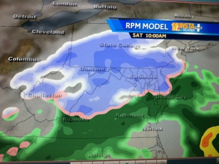
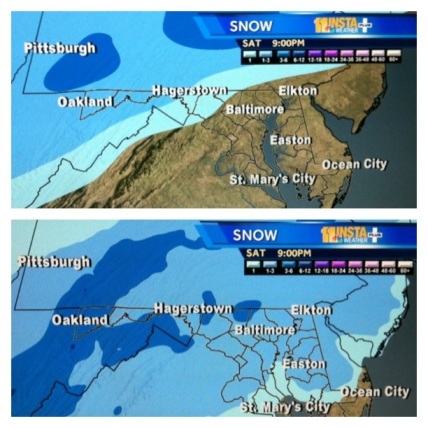
The precipitation will likely start sometime in the morning, as snow in the north and a wintry mix in the south. Some areas could see a few inches, with higher amounts in the northern counties.
As cold air continues to pour in from the northwest, the rain/snow line may sink all the way into southern Maryland and east into Delaware. While most of the accumulations will occur in northern areas of the region, we can’t rule out some snow or ice making it as far south as St. Mary’s, Somerset or Wicomico counties in Maryland.
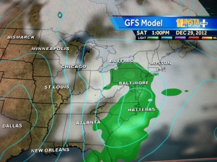
It’s important to note that not all of the forecast models are in agreement. The GFS keeps the accumulating snow north of DC and Baltimore. However, because the past two storms out-performed the models (they brought more snow than expected), we’re putting more emphasis on the models showing higher accumulations like the European model.


Leave a comment